Iceland trip 3: The west and west Highlands

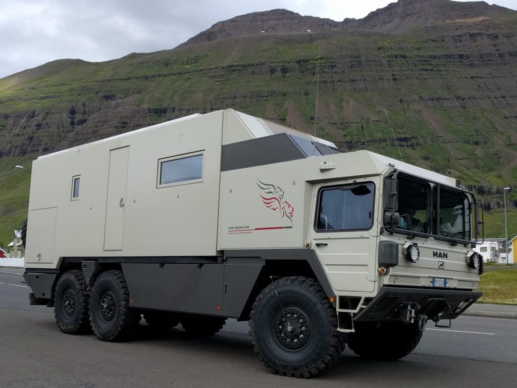
Day 12 (18.7) – Stykkishólmsbær to Borgarnes

To my dismay, Stykkishólmsbær campsite had open outdoors showers. It had new toilets with plenty of space, but for some reason they installed the showers outside the building. It was quite chilly, so I decided not to use them. It didn’t have any other facilities. Camping one night was 12.5 €.

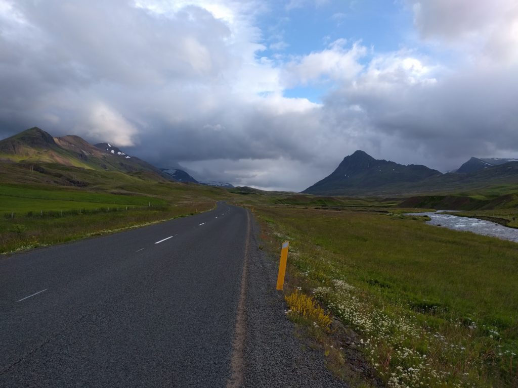
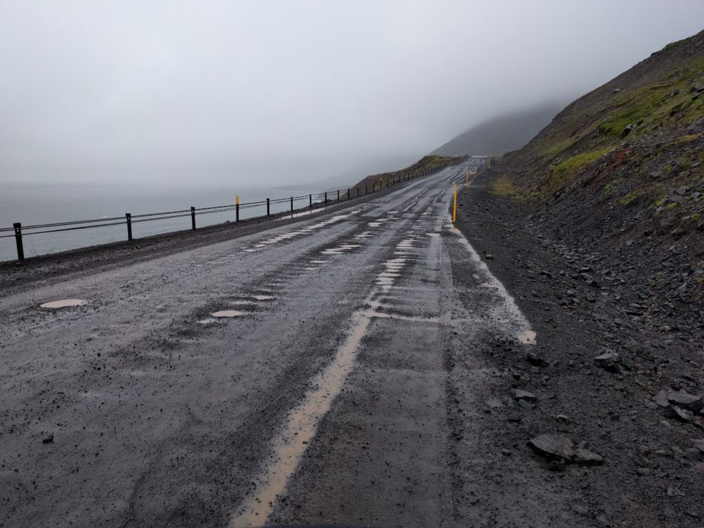
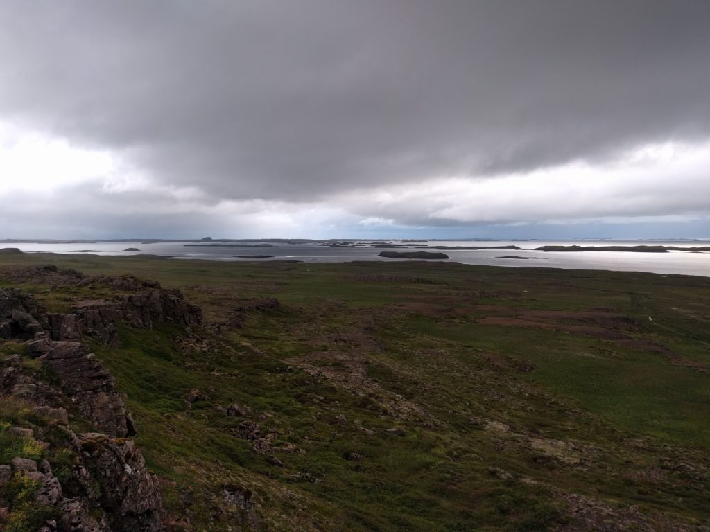
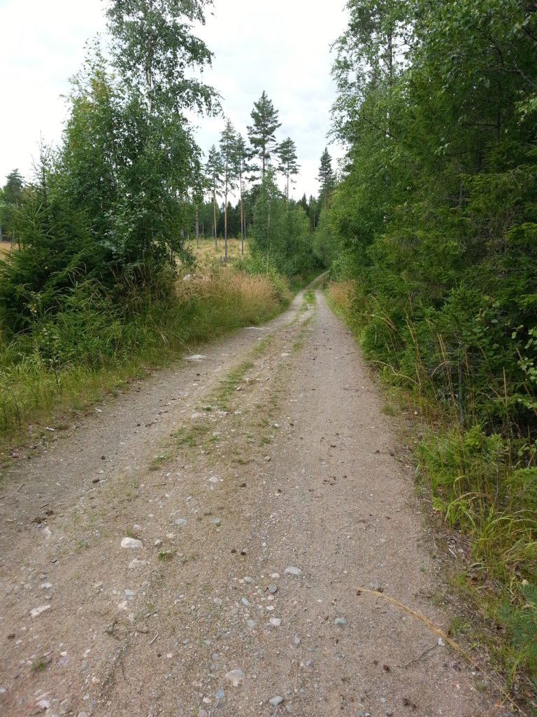
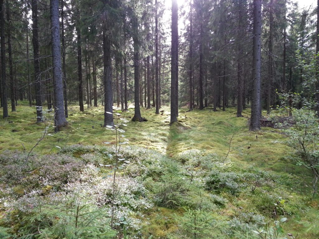
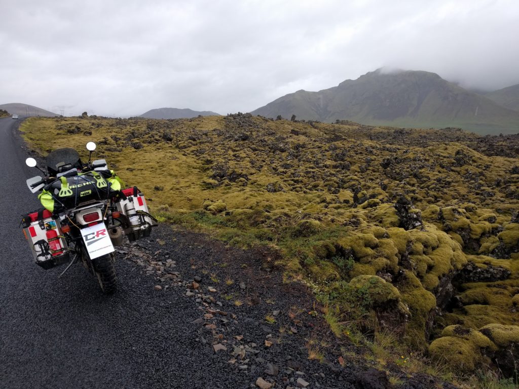
I filled the tank with 12 € and continued west through road 54. I stopped in this location to take the picture below.

Berserkjahraun lava field (Iceland)

In some town of the way I stopped to eat fish and cake for 31.2 €, but unfortunatelly I can’t recall where. So far so good, I continued my way to road 574 in order to visit Snæfellsjökull National Park. And that’s how I got in deep, deep trouble.

In Iceland, if you ride a motorcycle and cars flash their lights at you, they are probably warning you about strong winds. I didn’t know that, neither I knew how bad it could get. I just kept going and by the time I realized it, it was too late. I had such a strong side wind that, in a straight road, I leaned my bike more than I usually do in curves. Of course the wind blew in gusts, so I had to drive in esses to compensate. Because I couldn’t drive straight, I had to drive slow to stay in my lane. I knew that if I stopped or tried to turn around the wind would push me over, so I could only keep going. Moreover, there was a fog that prevented me from seeing much of the Park. I recently contacted the Icelandic Met Office and they kindly gave me the figures of that day and area: maximum wind speed 12 m/s, maximum gust speed 20 m/s.

Somehow I didn’t fall or went out of the road lane, and after several endless hours I could take shelter in the cafeteria of Hotel Rjúkandi. I spent 4.8 € in a hot chocolate to warm up, and I left a good tip because they were very kind and understanding with the mess I made with my wet clothes.

I had accommodation booked in Borgarnes, so I continued my trip despite the strong winds. Fortunately they were not as bad as in the tip of Snæfellsjökull.

Day 13 (19.7) – Borgarnes and Langjökull

In Borgarnes I took a badly needed break from campsites in Blómasetrið Homestay. This is a guesthouse that has everything you may want or need in the rooms, living room, kitchen and bathroom. The decoration and furniture creates a cozy home-like atmosphere. The people that run it were kind and helpful beyond duty. This was my best accommodation in Iceland and one of the best ever, I have no words to recommend it. It costed me 276.5 € for three nights.

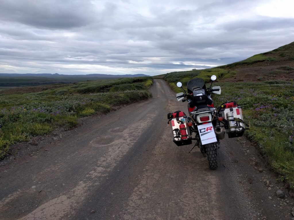
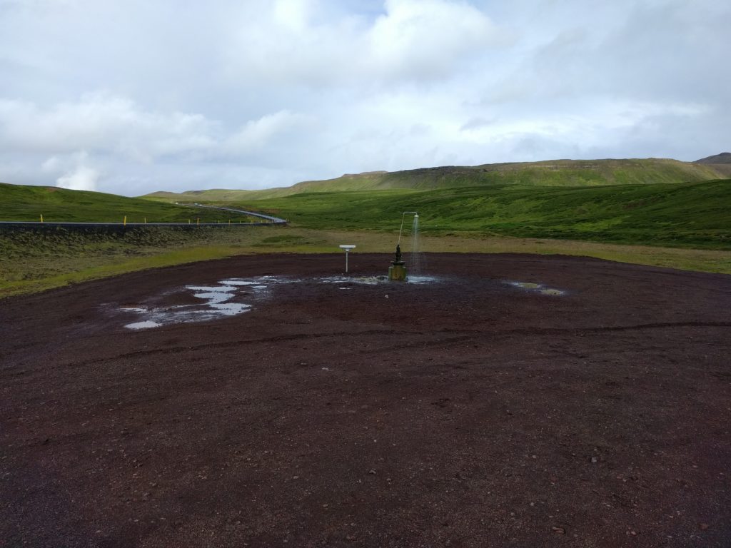
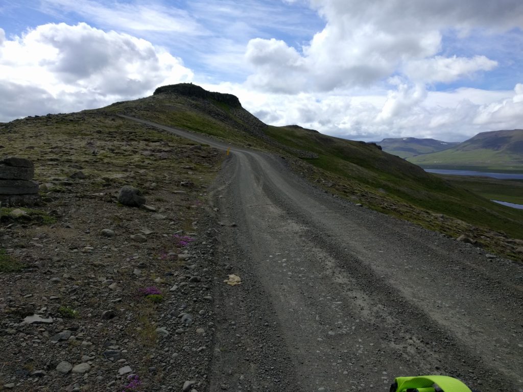
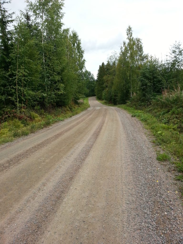
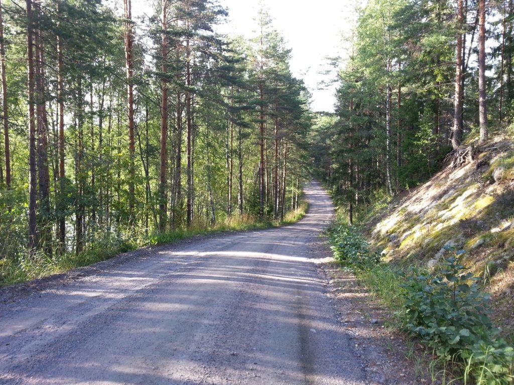
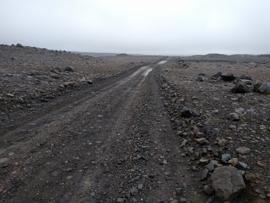
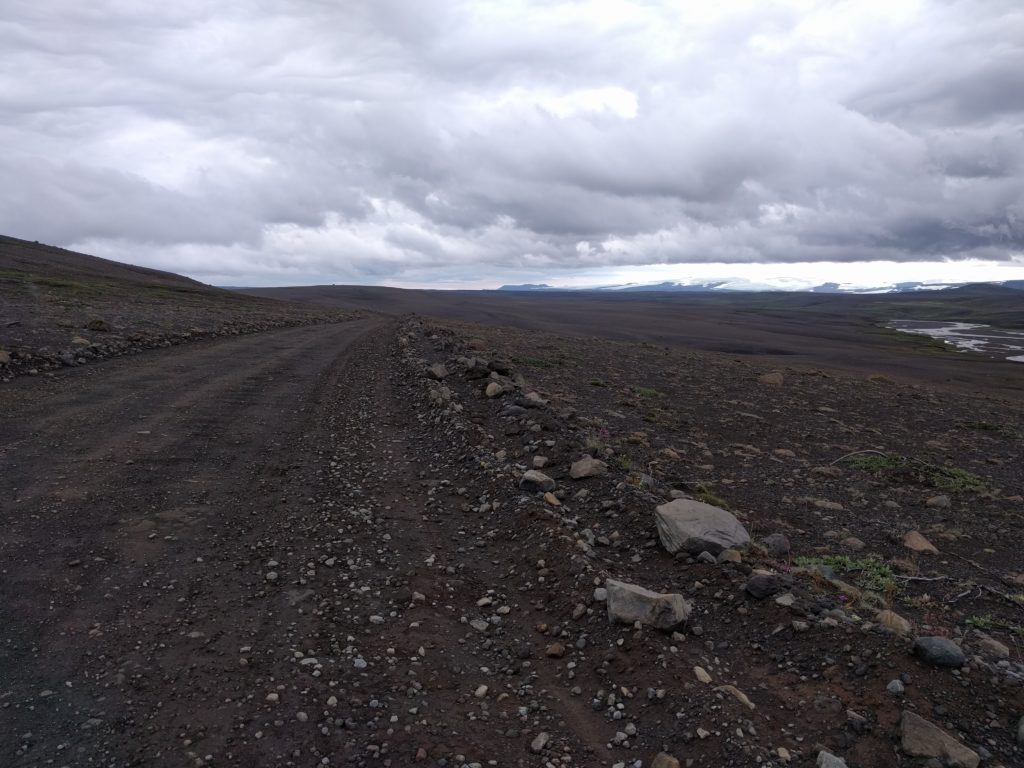
I filled the tank with 16 € and I took road 52 east until I reached road F550. I went north through road F550, also known as Kaldidalur corridor. It had potholes and stones but wasn’t that interesting. The landscape wasn’t that special either, a flat of rocks with occasional mountains and patches of ice. I took the picture below in this location.

Road F550, Kaldidalur corridor (Iceland)

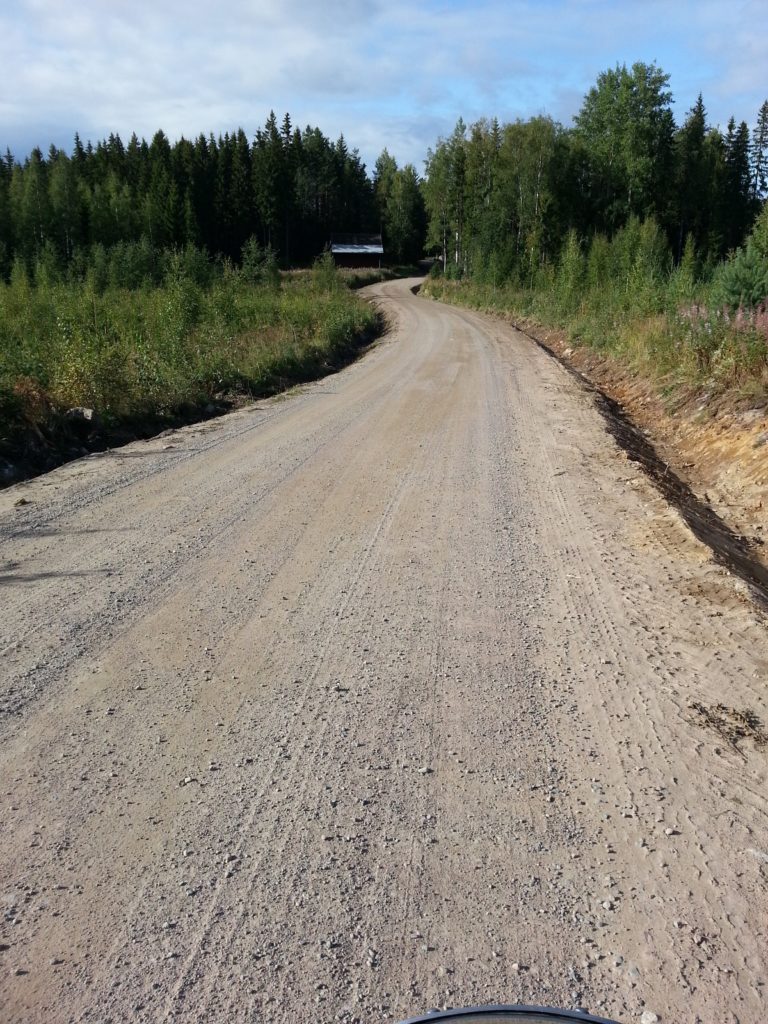
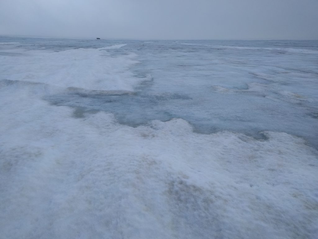
From F550, you can drive to the western edge of Langjökull glacier and have a walk on it. I took the picture below in this location.

Langjökull (Iceland)

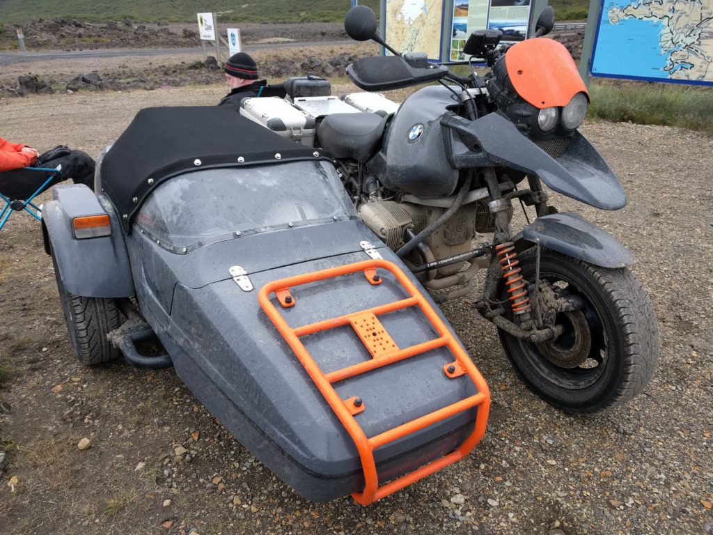
At the north end of the F550 I met a couple that was travelling in a peculiar BMW with sidecar. They were waiting for the tow service due to problems with the engine. The lady told me that she had an uncomfortable ride due to the short suspension of the sidecar.

BMW with sidecar in Iceland

I went to visit Víðgelmir cave. For 52.3 € it wasn’t cheap, but it was worthy. Better than one of my pictures, check the gallery in their website.

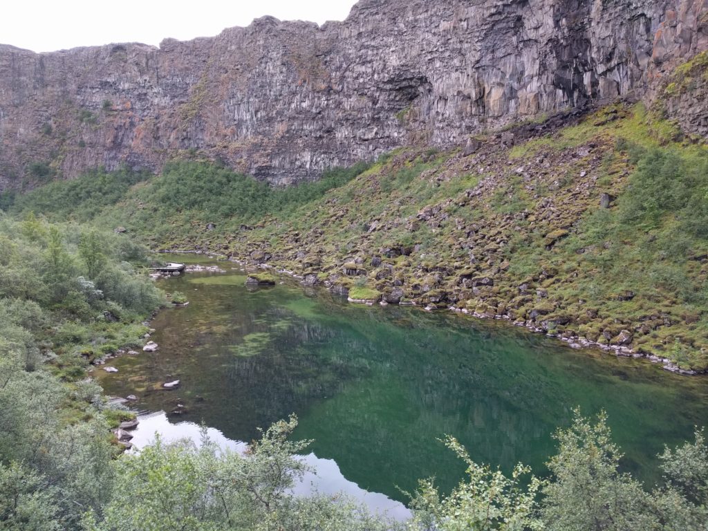
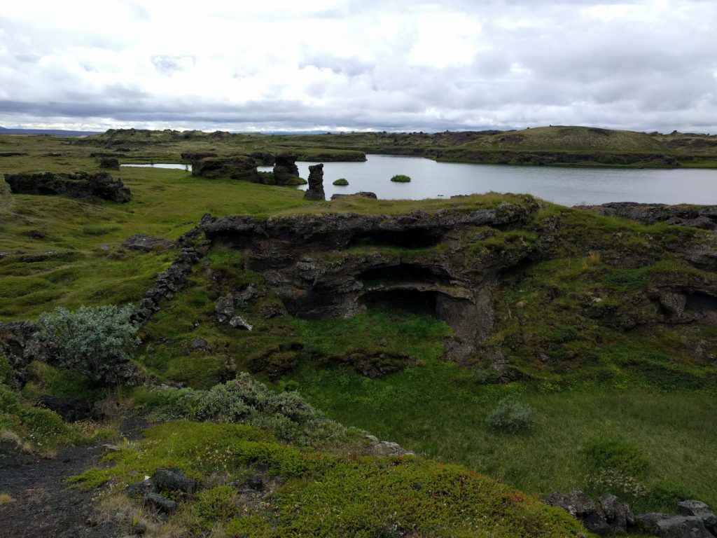
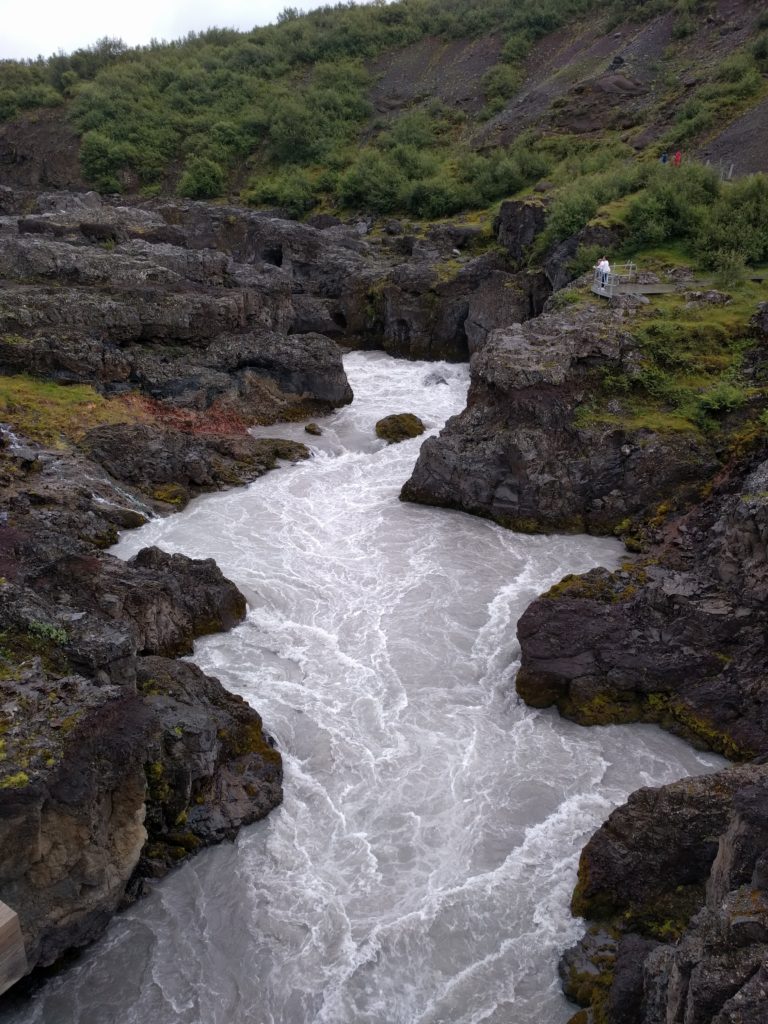
My next stops were the Hraunfossar cascades, Barnafoss rapids, and Deildartunguhver hot spring. I will share a picture of the rapids, but you should definitely look for more in the Internet.

Barnafoss rapids (Iceland)

I took the shortest route back to Borgarnes. As I remember, everything besides the F550 was asphalt. I had dinner at Borgarnes N1 gas station for 20.2 € and went back to my cosy guesthouse.

Day 14 (20.7) – Gullfoss and Geysir

I filled the tank with 18 € and I went to do road F338 from west to east. F338 is a curly road that goes through flats and small hills, and follows the straight direction of some power lines. The landscape is beautiful, including some lavender fields. It has several kinds of surfaces, mostly stones and soil, but also some parts of black sand. In one of those sandy parts I lost control and fell off the bike. Luckily it was a slow and soft landing, and the only time I fell in the entire trip.

At the east end of the F338 there are two river crossings that you can see at the end of the video. If you are unsure I recommend you to start from the east, otherwise turning around means doing the entire road again. F338 in one of the nicest roads I did in Iceland. If you are a rookie like me, I recommend it as a first experience crossing wide streams.

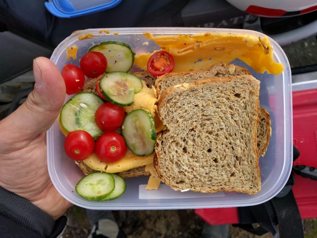
That day I learnt an important lesson: wrap your sandwiches with foil. Otherwise they can end as in the picture below.

Sandwiches messed during a route in Iceland

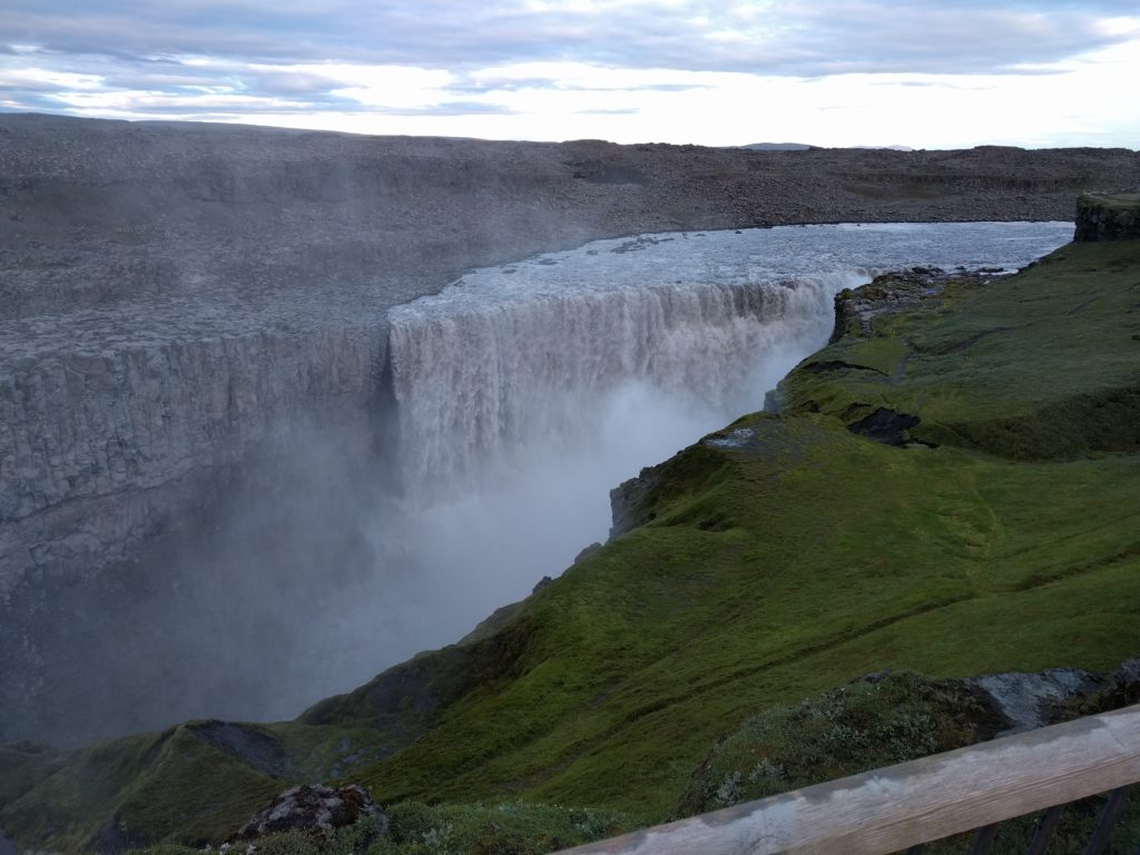
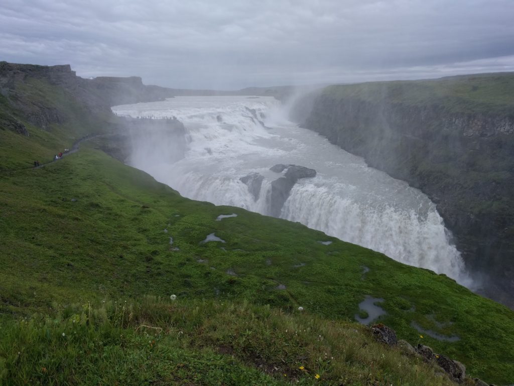
After road F338 I went to visit Gullfoss and Geysir, which are very close to each other. Gullfoss is almost as spectacular as Dettifoss. You can guess what the Geysir area is famous for. As a curiosity, the geyser that gave name to the phenomenon is currently inactive, but its neighbour Strokkur won’t disappoint you. And the amazing colors of the surrounding steaming pools are quite a sight on their own.

Gullfoss (Iceland)

On my way back I think I took roads 37, 365 and 36, because what I have in my notes is that I spent 1.6 € on the toll of Hvalfjörður Tunnel. Back in Borgarnes, I spent 29.5 € in groceries and 20.1 € in standard lubricant oil. I made the mistake of taking an almost empty bottle of chain lubricant for the trip, and in a small town like Borgarnes I couldn’t find it.

Day 15 (21.7) – Borgarnes to Kerlingarfjöll

Time to leave the comfort of the guesthouse. I filled the tank with 23.3 € and crossed Hvalfjörður Tunnel again (1.6 €). I continued in the opposite direction as yesterday until I reached Hotel Geysir. There I had a pizza and an ice cream for 20.5 €. My plan was to do F35 north and the gas station next to the hotel is the last one until the end; so I filled the tank and the external containers with 22.3 €. The gas in the tank turned out to be enough, but I didn’t know then.

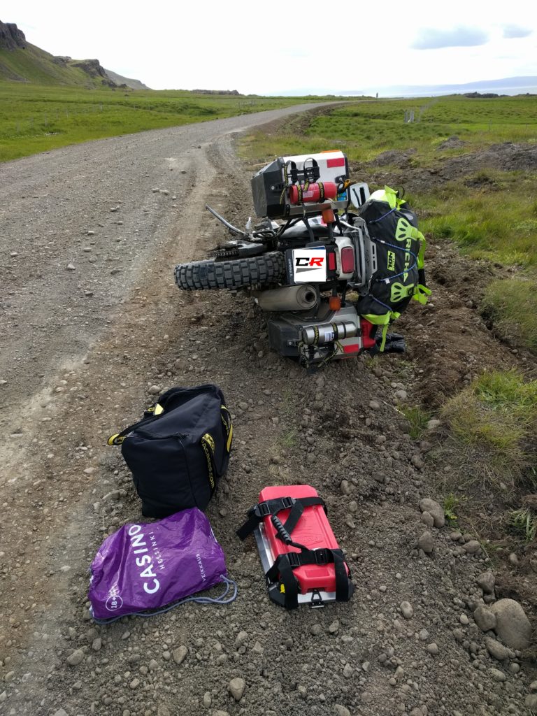
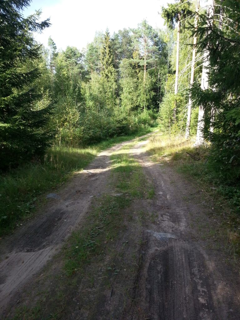
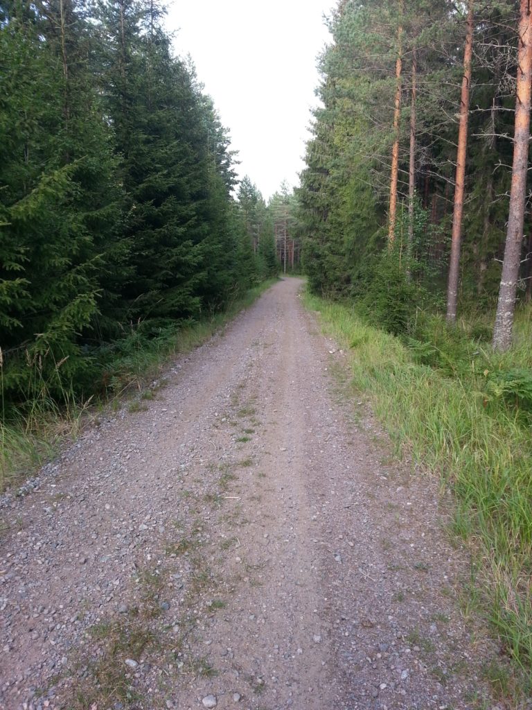
I followed road F35 north until Kerlingarfjöll. That part of the F35 is an average Icelandic dirt road with potholes and stones, not specially good or bad. The picture below was taken in this location. A few meters further, I lost a pannier again.

Road F35 near Kerlingarfjöll (Iceland)

I set up my tent in Kerlingarfjöll, where I was going to stay two nights.

Day 16 (22.7) – Kerlingarfjöll

Kerlingarfjöll has all the facilities you may need, including a cafe-restaurant. My only complain is the space to dry the clothes indoors, definitely small for all the people that want to use it. Two nights in a tent costed 33 € and include unlimited hot showers, a very good price. Besides that, I only spent 3.6 € in a coffee. I was eating sandwiches that I made with my supermarket groceries.

Camping, accommodation and facilities at Kerlingarfjöll (Iceland)

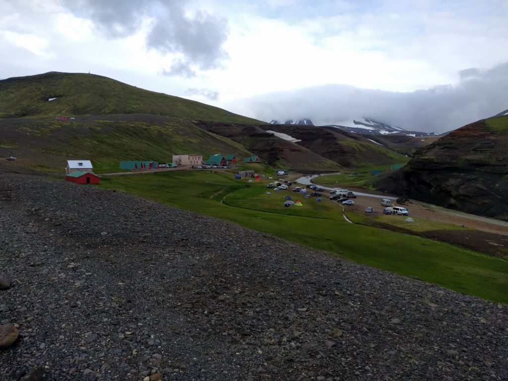
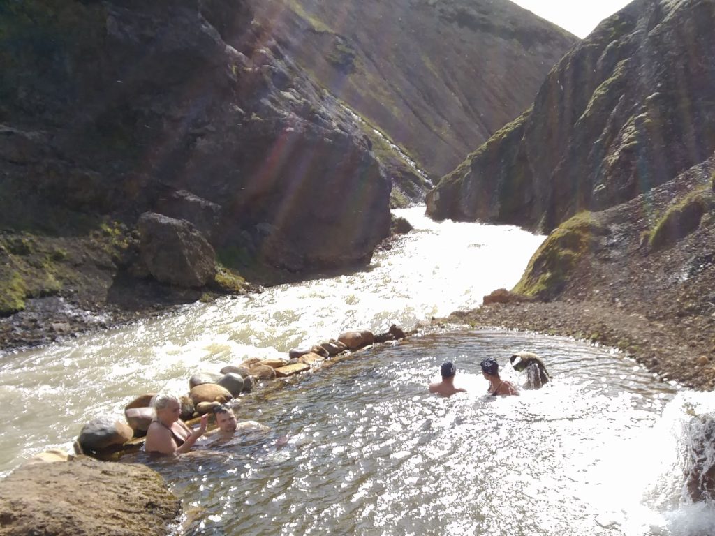
That day I gave Vacaburra a break because there are several amazing trekking routes in the area. I first went to the natural hot pool near this location. The water was perfectly warm and there are two fountains to massage your neck. The location is incredible, in a canyon next to a river. It was the best bath of my life. Bear in mind that the place has a wooden platform but no closed place to change your clothes.

Natural hot water pool in Kerlingarfjöll (Iceland)

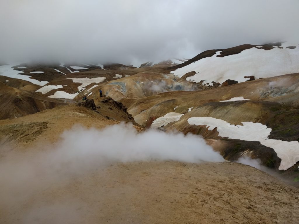
Then I took a trekking route. At some point it got a bit steep and there was snow and I was considering turning back. To be honest, it wasn’t that bad, it was me being lazy and not really into trekking. But then I remembered the motto of my trip, I haven’t come this far to come this far, so I continued. It paid off, because in this location I got to see one of the best landscapes of the trip. It had everything: hills, soil of multiple colors, patches of snow, patches of vegetation, steam vents… I felt sorry for the people who travel in normal rental cars, which cannot be driven in road F35.

Landscape in Kerlingarfjöll (Iceland)

When I arrived back to the camping I noticed three identical GS’s with almost consecutive Spanish plate numbers. I met one of the drivers and he told me that he and his friends bought the bikes together to get a discount. I was glad to meet some fellow Spaniards.

Spanish GS’s in Kerlingarfjöll (Iceland)

Day 17 (23.7) – Kerlingarfjöll to Hvammstangi

I had another 3.6 € coffee and picked my tent to continue north. Road F35 near Hveravellir has a perpendicular carving that makes the bike shake and the riding very annoying. I have seen such carving in roads in Finland, I guess it’s man-made. I first saw it in steep slopes and I thought it was for better traction. But then I also saw it in flats like in this case, and I wonder what’s the point. I didn’t take any proper picture of the road, but in this location there is a crossing where I took one of my favourite pictures of the entire trip.

Road F35 near Hveravellir (Iceland)

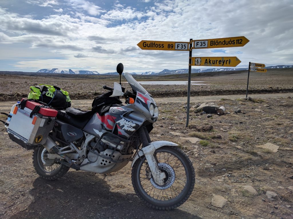
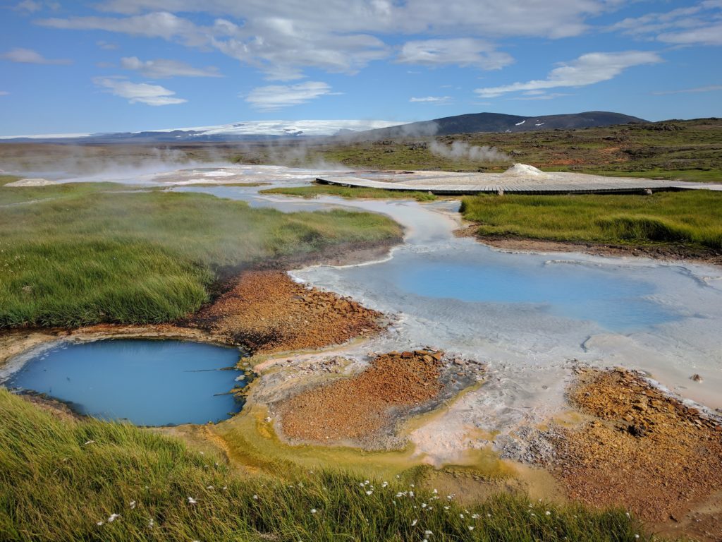
That crossing is were road F735 takes you from F35 to Hveravellir‘s thermal springs and campsite. The area is not so spectacular and the facilities not so big as in Kerlingarfjöll, but it’s still a great place to stay and visit. There is also a natural pool of hot water, this one with a house to change your clothes next to it. I just stopped to visit the area and take pictures like the one below.

Hveravellir (Iceland)

From Blöndulón road F35 gets flat, straight, wide and with a good surface. You could get there from the north in a normal car, but it’s still forbidden for rental cars. The interesting part is the views of lakes, mountains and glaciers. Don’t forget your binoculars.

This was the first gas station I reached. I only needed 7.1 € to fill the tank because I had been filling from the containers. It was a total of 254 kilometers between gas stations. Next to the station there is North West Hotel & Restaurant where I had a good dinner for 30.3 €. Finally, I reached Hvammstangi to stay overnight.

Iceland trip 2: The north

Day 7 (13.7) – Seyðisfjörður to Húsavík

The ferry arrived to its final destination in Seyðisfjörður in the morning. Customs just asked how long I was planning to stay and put a sticker in the windshield of the bike. I shall write about the town when I tell you about my last day in the country; that day I just had to get going.

MAN adventure truck disembarked in Seyðisfjörður (Iceland)

One thing that caught my eye is this MAN KAT1 truck that also disembarked. This one is unique and has a luxury interior, you can see it here. It made me dream of traveling in a off-road truck, maybe when I retire.

Leaving Seyðisfjörður you reach Egilsstaðir, a good place to get provisions. I bought a road map for 17.5 € and groceries for 25.2 €. I also spent 43.2 € in gasoline. I filled the motorcycle tank and the empty Rotopax cans.

It was raining and cold, so I also put the Gore-Tex layer of my jacket and trousers in the toilet of the gas station. It was difficult to prevent my clothes from touching the dirty wet floor.

All set, I took the Ring Road north and then F88 south. The F88 is a fun road of black sand and stones that goes through a beautiful area of petrified lava. It was cold, it never stopped raining and I hardly crossed any other vehicle.

My plan was to spend the first night in Sigurðarskáli; and visit the ice caves of Kverkfjöll, Askja caldera and Herðubreið the following day. But when I came across the first river crossing, I thought it was wiser to turn around. You can see the conditions of the river and the weather, and part of my route back north, in the video below.

You may argue that river can be crossed in a motorbike. But bear in mind that I didn’t have any experience, the conditions were bad, and if I got in trouble it looked like I wouldn’t get help in hours. I thought of the high risk of ruining a trip that cost me a lot of time and money to prepare, the very first day. I still think I took the right decision.

Later in the trip I crossed many other rivers. Now I think I could easily cross that one. I would definitely try if I weren’t alone. One of a hundred reasons to go back to Iceland, some day.

Anyway, I went to visit Hverir Geothermal Area and then went to Húsavík, where I booked a whale-watching tour and was going to stay the following two nights.

Day 8 (14.7) – Húsavík and Jökulsárgljúfur

I stayed in Húsavík Campground. To be honest, the facilities were quite bad. The showers just had a few hooks to leave your clothes and the floor was dirty with the outside mud (Some people took their shoes inside the shower room instead of leaving them outside). The eating room had a few chairs, half of them broken. At least they had a very convenient heated room to dry your clothes, I give them that. But unless you are traveling in a caravan with all the facilities, I would avoid this campsite.

Most Icelandic campsites don’t have an office, someone passes by collecting payments in the morning and afternoon. It would become my routine to arrive in the evening and pay the following morning. This one costed 19 € for two nights. There is a Camping Card, but not for every campsite and definitely not worthy for the amount of nights I would use it. However, I got the impression that campsites that accept the Camping Card have good facilities, so it’s a good reference.

That morning I went on the whale-watching tour that I booked the previous day. I had a coffee while waiting for the ship (2 €).  The tour costed 82 € but it was worthy. We were extremely lucky to see a whale breaching, very rare in cold waters.

Whale-watching in Húsavík (Iceland)

After that I took the bike to do road 862 south. 862 is a nice challenging road full of potholes and probably ponds after raining. The views were great. The picture below was taking in this location.

Road 862 (Iceland)

I must confess that my morale was low that day. I missed important sights the previous day, the weather was always bad, the campsite disappointing… I had a difficult entry to the country and I was regretting I came. But in Jökulsárgljúfur, I started to realize what Iceland has to offer.

I don’t want to waste time with long descriptions of the sights when you can find plenty of information, images and videos in the Internet. But whatever you may read or see, can’t compare with being there and seeing it for yourself.

Ásbyrgi (Iceland)

My first stop was Ásbyrgi, a beautiful canyon with a pristine river and gorgeous vegetation. There is a campsite right there. There are other campsites in amazing locations in Jökulsárgljúfur.

Dettifoss (Iceland)

I’m only going to tell you one thing about Dettifoss: It turned out to be the best, most spectacular sight of my entire trip. After reaching the south end of the road I went back to spend my last night in Húsavík.

By the way, it was that day in road 862 when I lost a pannier for the first time. Back in Húsavík, I got a Vodafone data SIM card (14.5 €) that I should have bought the previous day in Egilsstaðir.

Day 9 (15.7) – Húsavík to Sauðárkrókur

You see, I made quite a detailed plan of the route I was going to follow. Accordingly to that plan, from Húsavík I was going to do the Sprengisandur route (F26) south. The F88 showed me that I had underestimated the difficulty of river crossings, so I double checked the F26. I came to the conclusion that it was way too much for my skills. I wonder if the entire route can be done in a motorcycle, actually. I had to redo all my plans in a way that I still used the accommodation bookings I had. I would later learn that the weather can ruin your plans too.

Things can always go wrong and you have to adapt and improvise. That morning I stepped on my glasses while I was looking for them inside my tent. One glass cracked but still stayed in place, and I had the prescription sunglasses if the sun showed up some day. I later noticed that my tent has pockets in the corners.

Anyway, I picked my tent, filled the tank with 14.5 €, and I was on the move again. Until then, I had been filling the tank with the gasoline from the panniers as soon as I could. Better keep the cans empty if you don’t need them.

First I went to Krafla. I think the main sight there is Víti crater, but instead of that I want to show you the shower of thermal water that stands here, in the middle of nowhere. Somebody actually came by car, took a shower and continued her trip.

Thermal shower in Krafla (Iceland)

If you want to see what Mývatn has to show, go around by the southern road 848. That’s the next thing I did, and I took the picture below in this location.

Mývatn (Iceland)

Then I made a stop at Goðafoss waterfall and continued west in the Ring Road through Öxnadalur valley, where the road is dull but the views are great. The picture below was taken in this location.

Öxnadalur (Iceland)

Somewhere along the route I had lunch and ice cream for 35 €. The meals I don’t mention, it’s because I just made a sandwich with the things I bought at a supermarket, which was usually the case.

Finally I arrived to Sauðárkrókur, where I filled the tank again with 20.2 € and was going to stay two nights.

Day 10 (16.7) – Tröllaskagi

The camping in Sauðárkrókur only has toilets and showers, but at least they are new and good. It costed 19.2 € for two nights, plus 4 € for using the showers twice. In most Icelandic campsites you pay extra to have a limited time of warm water in the shower.

That morning I spent 11.3 € in groceries and off I went. The plan was to go around Tröllaskagi peninsula. I didn’t visit any special sight but the route and the landscape were epic.

I first went around in road 76. Parts of the road didn’t have asphalt and even had potholes, like in the picture below taken in this location. This uses to be the case in Iceland, secondary roads with different surfaces depending on the part.

Road 76 (Iceland)

I stopped in this place to have a coffee and a sandwich for 9.2 €. I totally recommend it. After that I took the tunnels to Ólafsfjörður and from there I took roads 802 and 82 west back to road 76. You may notice that for Google Maps that is not road 82, but accordingly to my road map and the Lonely Planet guide, it is.

802 and 82 are dirt roads with pot holes. Not that challenging, but the mountain pass of 82 was spectacular. Notice the birds flying in front of me at the end of the video. I don’t really know the reason of their behaviour, but I think they were acting as bait to lead me far from their nests. Many Icelandic birds nest on the ground due to the lack of  trees, and they can be very aggressive if you approach theirs nests.

After these, I just took 76 back to Sauðárkrókur. It was cold and raining all day. The Gore-Tex layer did its job, but when I arrived to the campsite my gear was soaking wet. I had to go straight to sit on the radiator of the toilets until I stopped shaking. That was my first lesson in how bad the conditions can be in Iceland, but it wouldn’t be neither the last nor the toughest.

Day 11 (17.7) – Sauðárkrókur to Stykkishólmsbær

I picked my tent again and continued west, after filling the tank with 13.6 €. I went around Vatnsnes peninsula, taking roads 716, 717 and 711. They are good dirt roads with some gravel and potholes. The peninsula has many nice sights, like the remains of a fortress on top of the hill of the picture below, taken in this location.

Fortress hill in Vatnsnes (Iceland)

I made a stop in this location and between the uneven terrain and the strong wind, the bike ended as in the picture below. I was removing the luggage to be able to pick the bike up when some cars came and I stopped them for help. They saw my broken glasses and it took me a while to convince them that I didn’t have an accident and I was fine.

Bike pushed by wind in Vatnsnes (Iceland)

I made a stop at this station where I filled the tank again with 12.9 € and had a vegan burger for 14.7 €. N1 gas stations usually have good services. Then I went south to take road F586 west.

I think road F586 is a hidden gem of Icelandic off-road driving. It goes through mountains like 82; but it’s narrower, bumpier, curlier, more steep, and you get to cross a narrow river several times. If you are a rookie like me, it’s one of the first roads you should do: it will challenge you without putting you in trouble. Regardless of your experience, it’s the second best road I did in Iceland. I had a video but it seems I accidentally deleted it when freeing space in the memory card. So, unfortunately, I can only show you the turf house in this location.

Turf house next to road F586 (Iceland)

To get into road F586 from the Ring Road, you need to cross a gate. Make sure you leave it closed behind you. The reason for the gate and its fence is the sheep that roam freely in most of the country. Be extra-careful with them: the lack of predators hasn’t made them most cunning or agile animal on earth. For some reason they like to be on the roads; and they have unpredictable reactions or not react at all when you get really close. It’s not rare that they stand in one side of the road and cross in front of you at the very last moment.

I continued west through road 54, which was a good dirt road. The views of the coast were great, like the picture below that I took in this location.

View from road 54 (Iceland)

I spent the night in Stykkishólmur, from where I started the western part of my trip.

Loppi

For this day trip I looked at Google Earth again and decided to go west of Hyvinkää, not remembering that I have been there before. You may notice the lower quality of the pictures, taken with my old Samsung Galaxy S3 because my Nexus 5X was being repaired.

I took the E12 north to Hyvinkää and then 1361 west. The first gravel roads that I tried were the beginnig of Jauholammintie and Piilolammintie. They are the typical hard-soil and gravel roads, in this case narrow and with poor curve visibility due to the vegetation. Not worthy.

Piilolammintie (Hyvinkää)

I continued west in the 1361 and tried Kenkiäntie. Without pretending it, I was again in the road where I had the fall. I have come to hate these roads of gravel over hard soil, it’s like going over marbles. Treacherous and not fun.

Kenkiäntie (Hyvinkää)

I went west in Hirvijärventie. Until Rantala it is paved and with many houses by the road, then it’s again a gravel road and still many houses.

Hirvijärventie (Loppi)

I went up and down Pitkäjärventie. This a more interesting forest track with some stones and grass, only too short.

Pitkäjärventie (Loppi)

I took Hirsmäentie and Nyynäistentie north until road 54. They didn’t have so many houses as Hirvijärventie but they were the same kind of roads.

Nyynäistentie (Loppi)

I took 54 west (which is an asphalt road) and then Kaakkomäentie and Ourajoentie north. Same again, hard soil, gravel, few houses.

Ourajoentie (Loppi)

I went back to 54 and tried Kalamajantie south and Niitymäentie north. (You can go all this way despite not being connected in Google Maps). Same thing as before, except for this part which is a forest track similar to Pitkäjärventie. I took the picture below in this location.

Niittymäentie (Loppi)

There are some hunting posts that I used to place my camera and take videos of myself passing by. In this location the forest was covered with moss and I could take the nice picture below.

Forest near Niittumäki (Loppi)

I continued south on Hirsijärventie and then north-west on Eräläntie. Hard gravel roads again, with some nice views of forests and lakes.

Eräläntie (Loppi)

I took Takalammentie east and the track that goes to Kurtlammi lake. Takalammentie is still hard soil, but the other is a short forest track with stones and grass similar to Pitkäjärventie, as you can see in the picture below.

Track to Kurtlammi lake (Loppi).

South of Takalammentie there is another nice short track that doesn’t exist in Google Maps. In this location I took a picture of it that you can see below.

Track west of Sylkkiöt lake (Loppi)

I decided to call it a day so I took roads 2832, 132 and E12 back to Helsinki. I must say that, if you like asphalt, 2832 is a nice slightly curvy and hilly road with good pavement and little traffic.

So, not a good area for off-road driving. The few nice tracks were too short. At least, I know where not to waste my time again. The season is coming to an end, so next time I will probably repeat Ylimmäinen or Kalkkivuori.